View Spread


Zoom in on Physical Maps
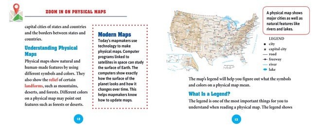
Readers will learn how to use maps to locate the world's oceans, rivers, mountains, and deserts. This graphic-rich book not only explains the important features of physical maps and why people use them, but it teaches the all-important skills of reading maps. From a compass rose and legend, to color coding and latitude and longitude lines, students get a taste for the basics of map reading. A follow-up activity allows students to pinpoint directions to a few secret locations around the globe.
RL
Grades
2 IL
Grades
K-4 GRL
G